By CHRISTIANE BIRKETT
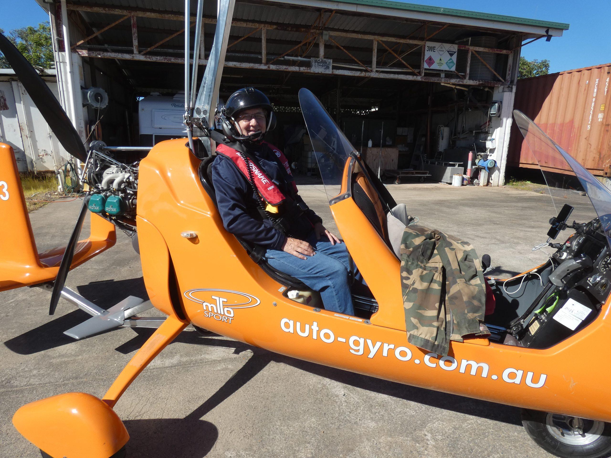
‘Clear prop!’ That’s the catchphrase signifying the start of a flight in the gyro-copter – the rush of adrenaline as the craft becomes airborne, and eagerly looking down, and across, to see how similar, or how different, the scenery is so far away from Gunnedah.
It was indeed very different late last month, when, to the best of my knowledge, I became the first woman, and certainly the first librarian, to fly around Hinchinbrook Island in a gyrocopter!

As Dan checked my life vest before we took off he joked: ‘It won’t do you much good anyway if we go down in the sea! We’ll be eaten by sharks and crocodiles!’
Hinchinbrook Island dominates the horizon; it’s visible from Ingham which was our base for four days.
It’s not your typical tropical island paradise either, with white sandy beaches, palm trees, and crystal clear waters.
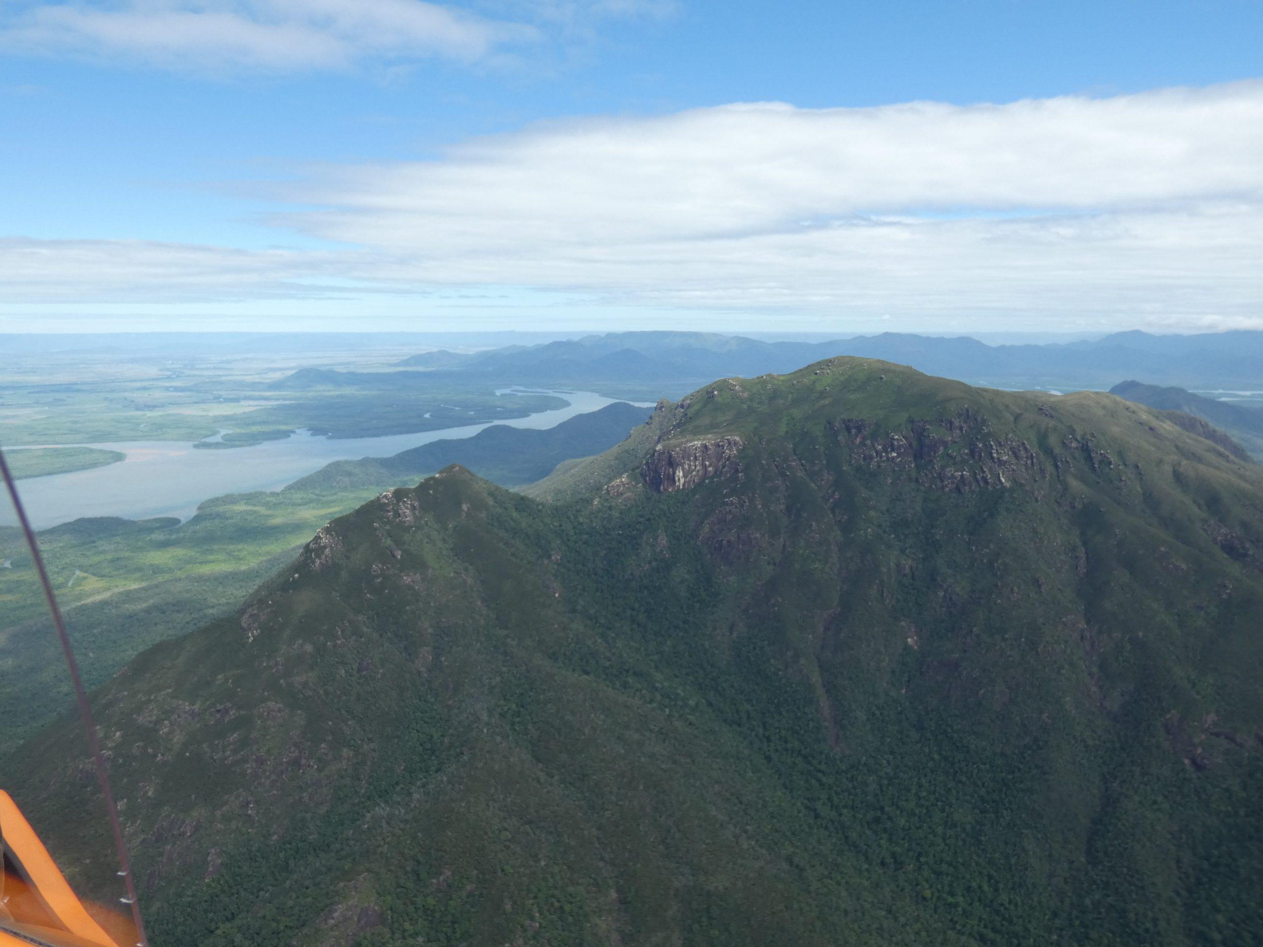
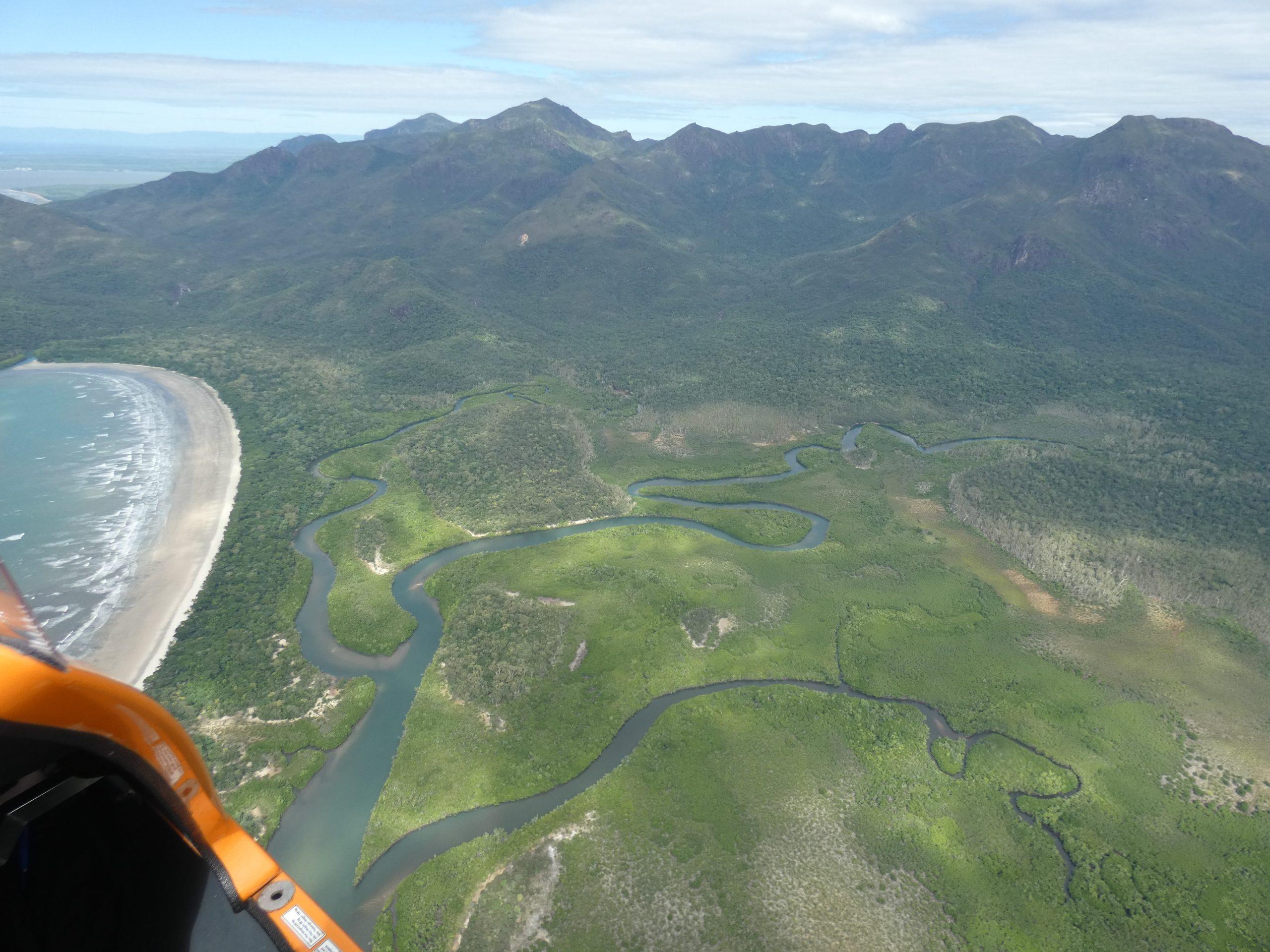
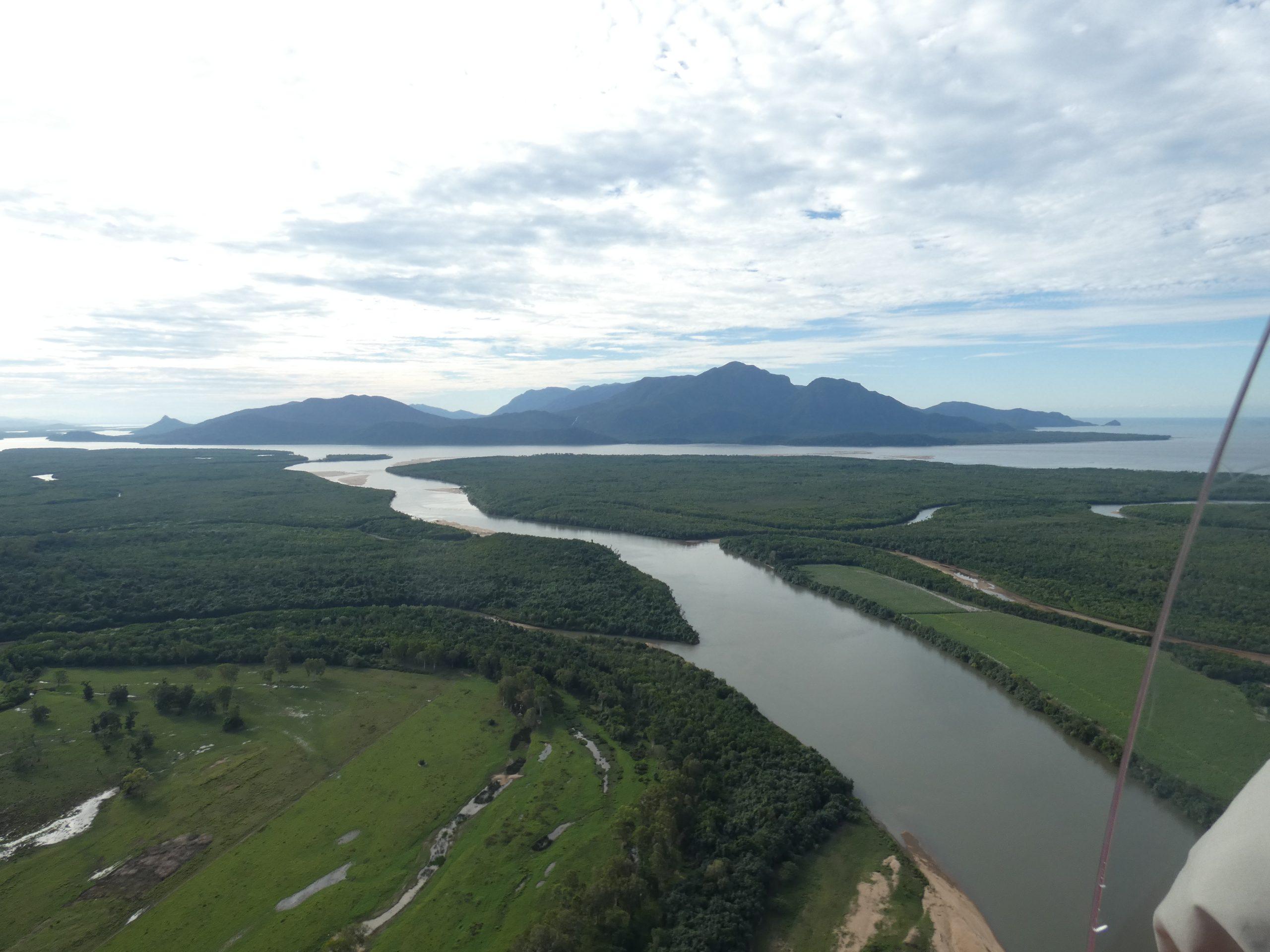
It’s more like a landscape from the dinosaur era – there’s a backbone of high rugged mountains that drop to mangroves and then the sea. There are beaches on the seaward side of the island, but the landscape is raw and rough.
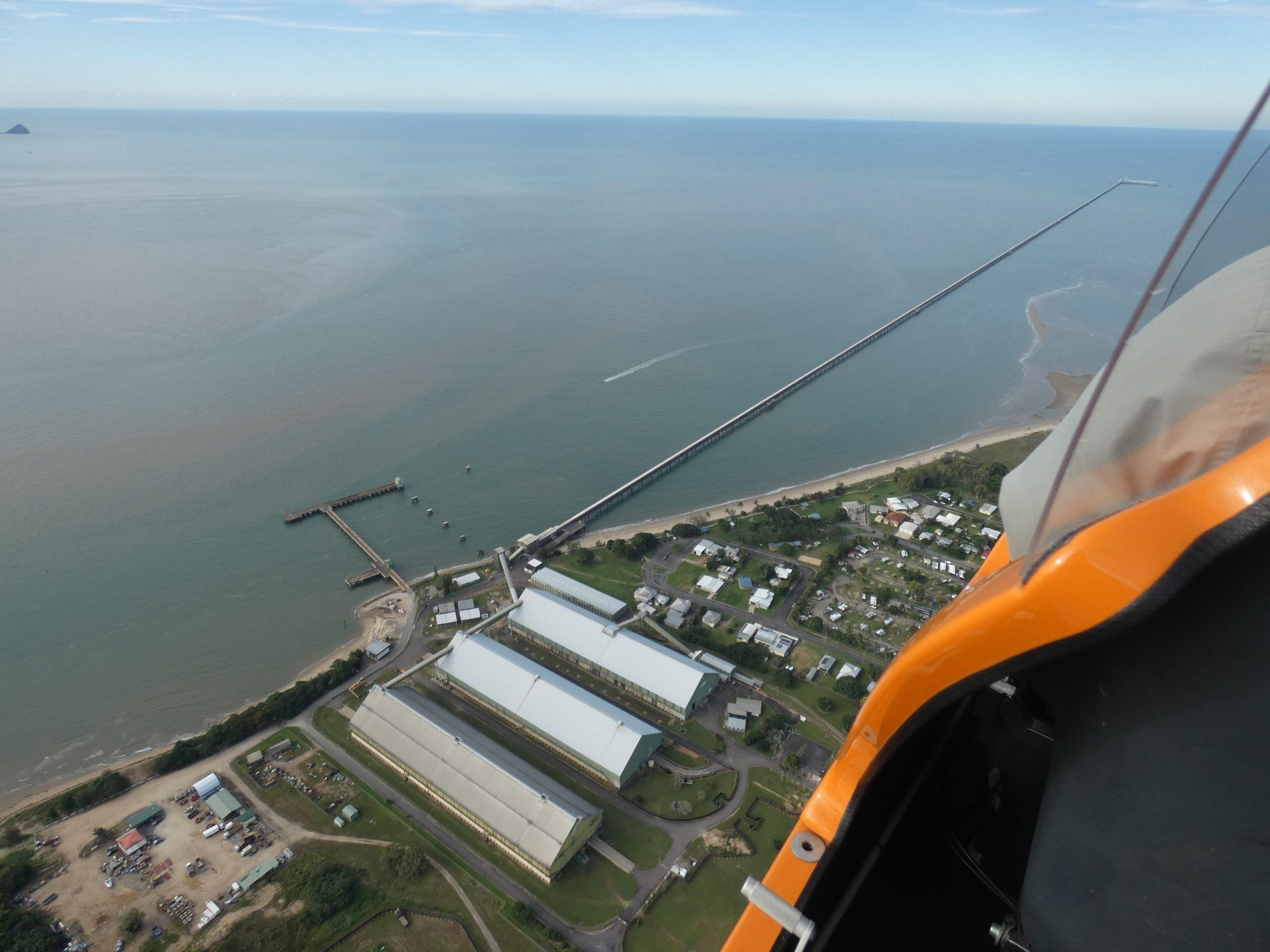
We flew across the sugar cane fields to Lucinda, and we followed the coast to Cardwell. On one side were the mountains and on the other side the tangled skein of mangroves, water and land known as ‘The Channel’, that separated the island from the mainland.
From Cardwell (home of the Big Crab!) we cut across the open sea to Cape Richards, where a high class tourist resort met its untimely end at the hands, or winds, of a cyclone some years ago.
Now the only sign of human habitation is a walking trail – extreme level of difficulty – and if you know where to look, the ruins of a WWII bomber that collided with Mt Straloc.
As we followed the coast along the with the sea and the beaches to the left, and the mountains to the right, the journey became turbulent from the air currents swirling around the mountains. Add a strong headwind, and it was a relief to see the Lucinda jetty thrusting out into the waters – Gunnedah has its cotton gin, while Ingham has one of the largest sugar cane mills in Australia, and Lucinda, on the coast and not far from Ingham, has a bulk sugar terminal, and the longest jetty in the Southern hemisphere.
It’s almost 6km long, and although it appeared straight from the air, it apparently follows the curve of the earth! It allows large ships to be loaded with the raw sugar produced in the area.
Some comparisons between Gunnedah and Ingham:
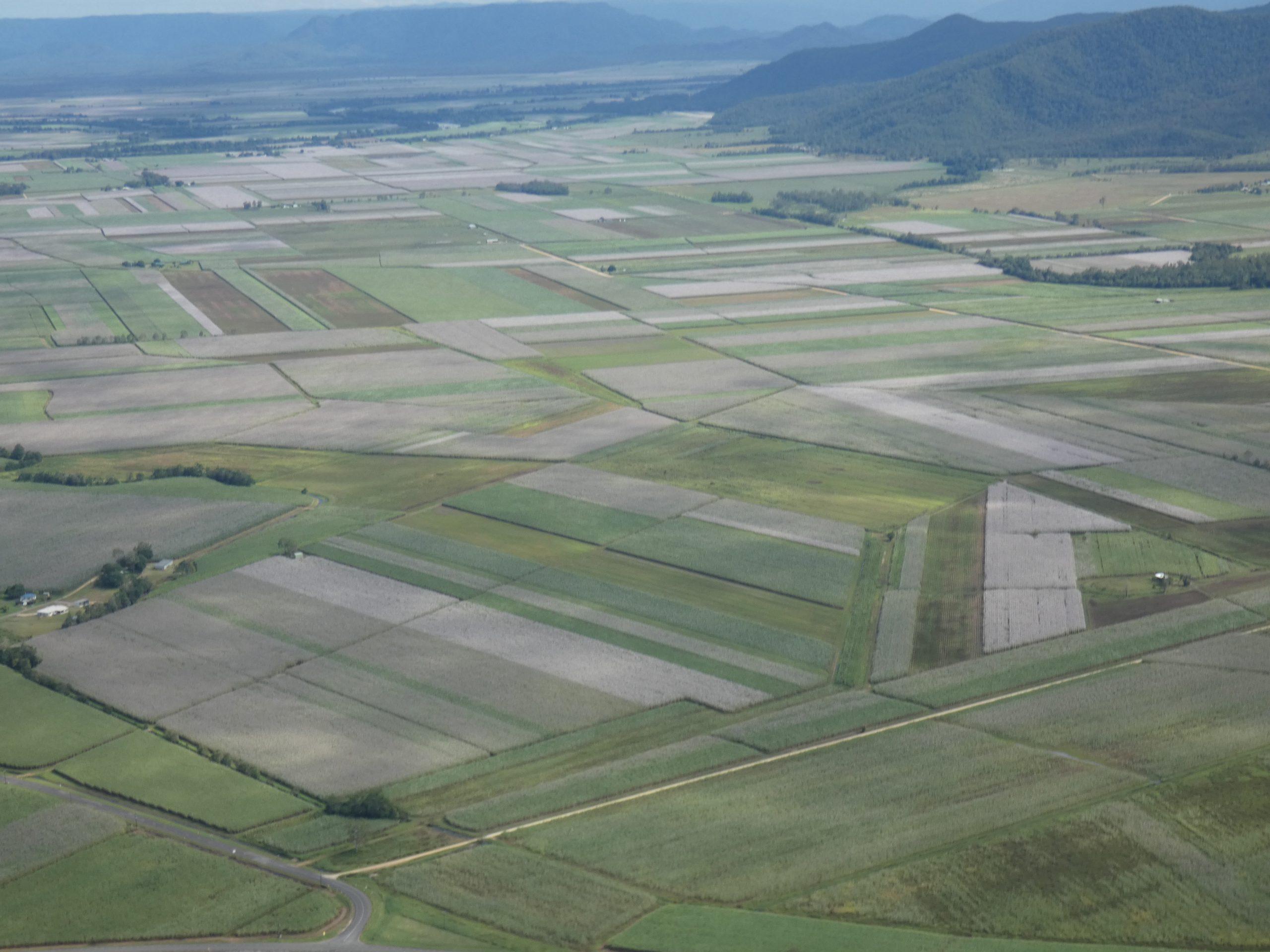
While Gunnedah has cotton, sorghum and canola, Ingham has sugar cane, and it’s patchwork quilt pattern of fields in flower, and fields ready to harvest is stunning from air. And unlike Gunnedah, which needs to irrigate its crops, sometimes with the irrigators that make such fascinating ‘crop circle’ patterns, in Ingham, they have to drain the paddocks of excess water, so sometimes there are slashing drainage lines through the fields!
Ingham, established in 1864, is a predominately Italian town, and Italians still constitute 55 per cent of the population if the second and third generations are counted. It’s known as ‘Little Italy’ and the former mayor described it as ‘living history’ as much of the language, culture and customs that are followed harken back to the times when their ancestors left Italy. It’s also probably the only place where you can walk into a café and just ask for a plate of home, hand-made ravioli that might not be even listed on the menu!
We arrived at Ingham airfield after nine days, and I was thrilled when I saw one of the brilliant blue Ulysses butterflies as soon as I left the motorhome, one of the ‘must sees’ of the area!
Our trip began with a boggy beginning in early May, thanks to the 10mm of rain the evening before, and we travelled for four days to Bluewater, 30km north of Townsville, which is an international flight hub. There’s also a big military presence in the area, as well as national parks, so the airspace is tightly controlled and restricted flying conditions are in force.
Bluewater is a private airstrip at the end of a dirt road, surrounded by forest, and much used by helicopter trainers. It was also the home of a model aircraft club, who flew their craft on Wednesdays and Sunday mornings. The strip for ‘real’ planes was grass and rough, and I didn’t fly – we spent a few days catching up with family and friends.
It wasn’t until we arrived at Ingham, where Dan grew up, that we could both fly, and as well as our historic flight around Hinchinbrook, we also explored the district around Ingham, Halifax, Taylor’s Beach, Lucinda, Hinchinbrook Island and the Channel.
Dan flew to Wallaman Falls, described as the highest single drop waterfall in Australia, and he also followed the course of the Herbert River through the gorges of the Great Dividing Range.
Inclement weather forced his return to Ingham Airfield before he could fly to the headwaters near Herberton in the Atherton Tablelands.
Next stop was to be Atherton in the Atherton Tablelands, where we lived for 10 years. We are looking forward to flying over Lake Tinaroo, gazing down at Lake Barrine where we were married, and checking out the dairy farming and tropical fruits growing landscape.