The Gunnedah community has been given a bird’s eye look at the flood risk and potential effects of future flood events.
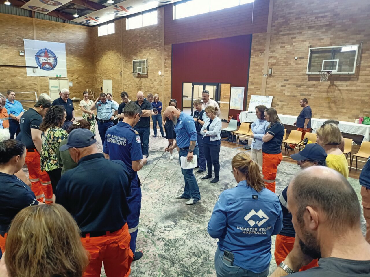
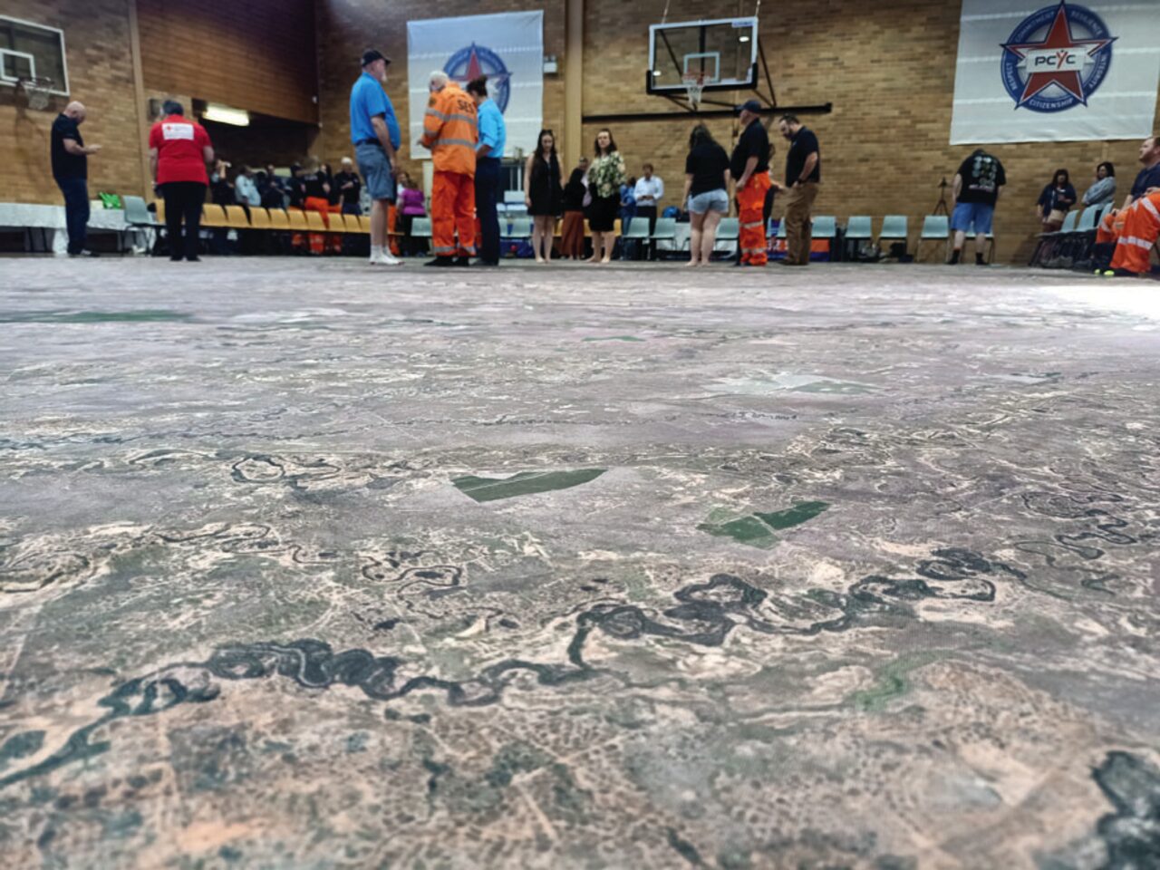
A 15-metre, large scale satellite image was rolled out at Gunnedah PCYC as part of an educational and information gathering exercise called ‘The Big Map’.
The event was hosted by Disaster Relief Australia which is staging similar events at flood-effected communities across the country.
National resilience manager and defence veteran Adam Moss described the ‘Big Map’ as a similar concept used by the military to brief commanders.
He said the map served as a visual “discussion piece” for the local community, and emergency services looking at previous floods around Gunnedah.
The detailed, aerial displayed featured flood-prone communities from the Hunter Valley to the Queensland border.
“It shows how the Namoi catchment works during flooding, from Tamworth to the Barwon and flowing into the Murray Darling,” Mr Moss said.
“From that we’re able to have discussions about community impacts, how long certain communities have for alerts, evacuations and movements.
“Then on the operational side, we can work with emergency services and organsiations like the SES and look at things like timings, water flows and peaks.”
Mr Moss said information collected from the community sessions at Gunnedah and Narrabri would be reported back to better inform future flood events.
“We’re not flood experts, we’re just taking information that we see and hear, turning that into data and local knowledge to feed it back to these emergency services who can use it operationally,” he said.
The ‘Big Map’ convenor said the community response in Gunnedah on Saturday was “extremely positive” as the event captured valuable flood information.
“Every community member who has come here today … the first thing they say is ‘I can see we live in a flood plain, there is flood risk here’,” Mr Moss said.
“We’ve been able to capture some great insights on local knowledge which we can put into our report.
“Also the SES can start using some of the operational data for flood events because it’s providing them situational awareness.”
Emergency services and stakeholders
Friday’s ‘Big Map’ event featured emergency services including local SES, police, fire and ambulance personnel as well as NSW government and Gunnedah council representatives.
The group heard regional areas like Gunnedah are at risk, partly because of the influx of new residents into the area.
The audience was told about 10 per cent of the 112,000 population in the Namoi catchment had moved to the area in the last 12 months and 29 per cent in the last five years.
Although the audience was cautioned that every flood is different and ‘past flood events don’t equal future events’ – many new residents were seldom aware of the flood history.
The expectations from first responders also varied markedly, especially if people had moved from city to country areas.
First responders at the ‘Big Map’ event explained some problems encountered were due to the shifting boundaries on water movements in the Gunnedah area during flood.
The first responders said “water is not flowing where it’s meant to flow” which meant it is missing the data recording gauges.
The group was told about the different types of river and rainfall gauges and how each operate to determine flood levels and also the inadequacy of monitoring infrastructure which is largely set up for “irrigation not flooding”.
Shortcomings were also evident in warning systems such as the ‘Flash Flood Advisory Resource’ which requires at least five hours lead-in time.
What the community said
The Gunnedah community told authorities Cohens Bridge, unaccountable infrastructure as well as a lack of radio and mobile phone coverage, are some of the biggest risks they face during flooding.
The survey responses were gathered during the two-day ‘Big Map’ event in Gunnedah last weekend.
The Gunnedah community also named text messages, alerts and letter box drops as some of the best ways to communicate flood information effectively.
The responses also said more education is needed about what to do after a flood in the clean-up phase. It suggested simple but important tasks like turning off mains power and gas connections before a flood. It was also noted power should be switched back on only after certification by an authorised technician.
The ‘Big Map’ event also asked Gunnedah groups across two days – the community and stakeholder agencies, such as the SES and local council – where they perceived were strengths and weaknesses in the flood response.
There were similarities between the two response groups – both agreed the ‘community-led approaches’ was lacking, marking this field as either ‘can be improved’ or an ‘area of weakness’. Other areas such as “inclusive engagement’ showed mixed opinion. While the stakeholder group thought the inclusivity was generally an area of strength, the community response saw it as an area for improvement or already a weakness.
RELATED STORIES:
- Community unaware of Gunnedah council’s role during emergency
- SES says big lessons have been learned from Gunnedah’s flood events
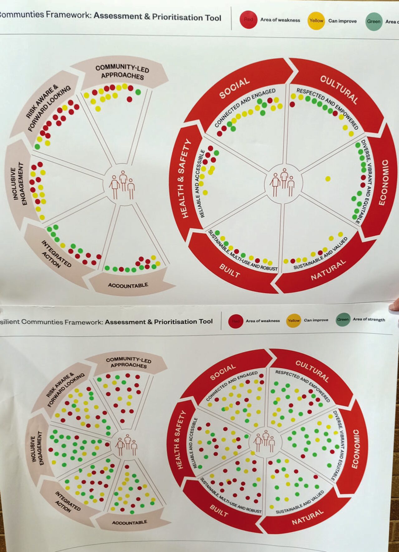
The Resilient Communities Framework: Assessment and Prioritisation Tool. Red dots = areas of weakness; yellow = can improve; green = areas of strength. The top chart represents the Gunnedah community’s view. The bottom chart represents emergency services and stakeholders.
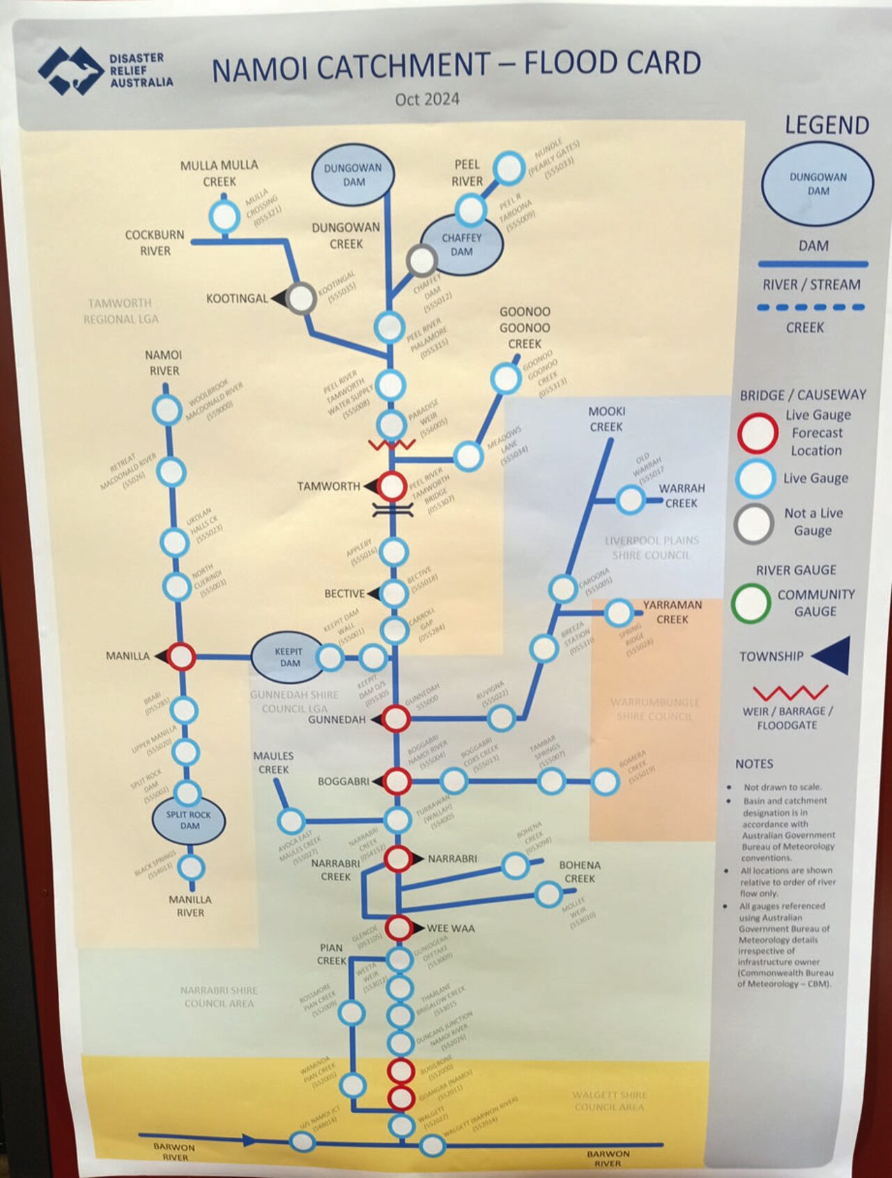
The Namoi Catchment – Flood Card.
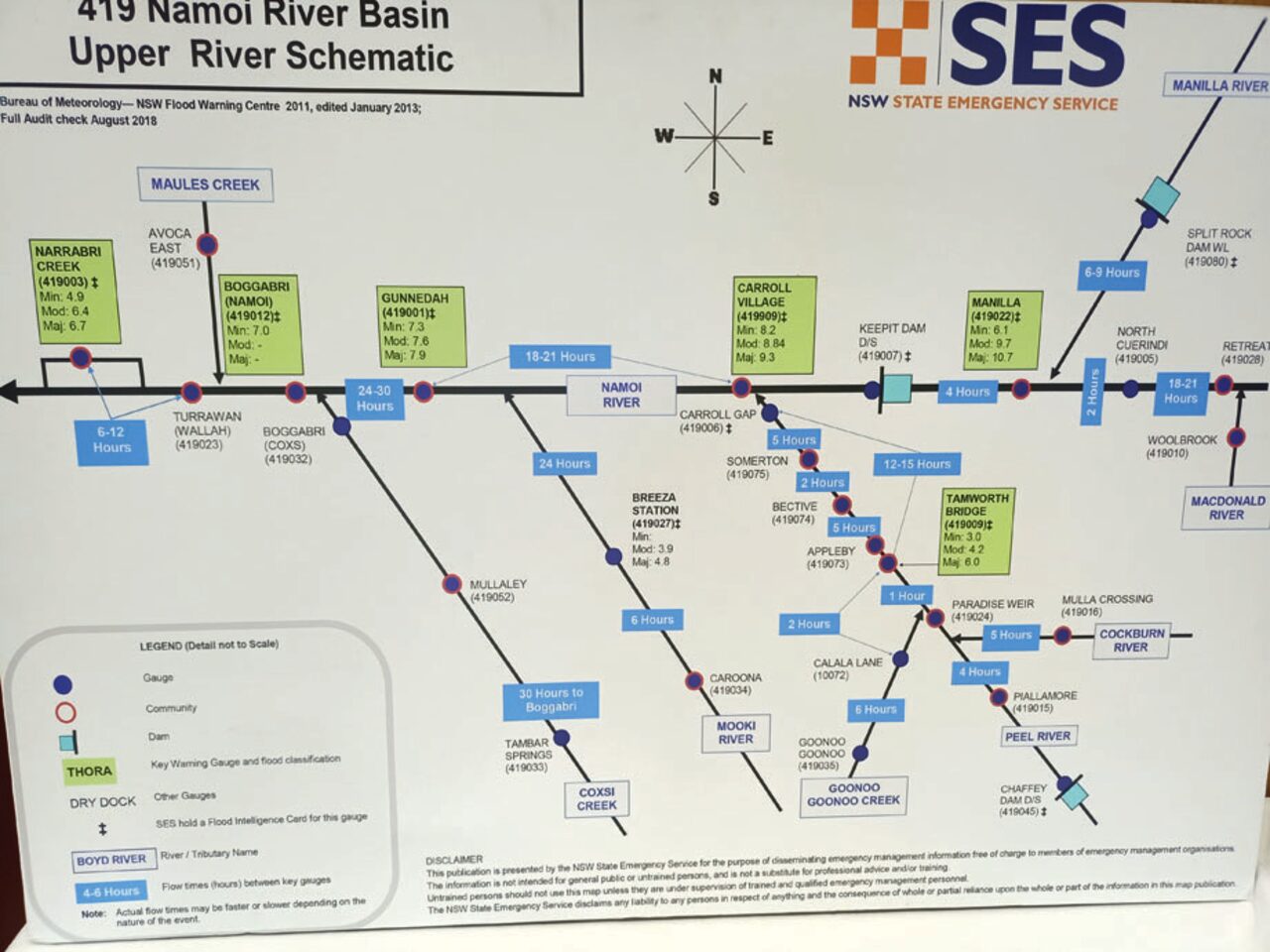
The Namoi Basin Upper River Schematic.
To order photos from this page click here