Gunnedah was plunged back into flood emergency mode in February 1971 when the Namoi River reached its third highest peak of 8.987 metres since official readings were first taken in 1892.
The rising floodwaters created consternation in the town, with most townspeople clearly recalling the record 1955 flood. After almost continuous rain between the Thursday and the early Monday morning, the 1971 flood bore all the traits of 1955 emergency.
The flood rains fell at a time when Keepit Dam was already close to capacity, heightening fears of Civil Defence that the 1955 benchmark could be exceeded. At the height of torrential rain on the Saturday night, the valley battened down for a huge event.

Though the flood was still an extreme event, there were several significant factors which helped to reduce its impact. High praise was extended to the officer- in-charge of Keepit Dam, Jock Ray, who “juggled” releases from the storage during critical periods. He was able to clear the crest of the flow through the dam before the arrival of the huge flow in the Peel River, which joined the system immediately below the dam wall.
Fortunately, too, the peak flow in the Mooki system reached Gunnedah after the crest of the main stream had passed through. It was also claimed that the lush growth of pasture and plains grass on the Mooki flood-plain had helped to hold back the arrival of floodwaters in Gunnedah.
The full length of the valley was subjected to flooding for weeks with heavy follow-up falls producing a second high peak of 8.44 metres in Gunnedah, 11 days after the first peak.
The 1971 flood re-ignited the old controversy over flood protection with a petition calling for the construction of a flood levee from Henry Street to below the saleyards circulating in the town for weeks and a public meeting, convened by local resident Bill Davis, drawing 100 people. A lively local campaign for a levee tailed off after several months.
Flooding returned to Gunnedah in 1974, when the Namoi reached a peak height of 8.51 metres on January 9. About 70 homes in Gunnedah had to be evacuated with about 60 people sleeping in the town hall – most of them stranded tourists.
More than 250mm (10 inches) of rain fell in the Gunnedah area in a 48-hour period and there were fears that flooding would be on a par with 1971. But less rain fell on the slopes of the Peel and Namoi Rivers and by the time this floodwater reached Gunnedah, the peak of the flood flow in the Mooki had passed, unlike 1971 when the main stream flow had reached Gunnedah first.
The Namoi Valley was subjected to further major flooding in 1976 when the river reached a peak of 8.78 metres on January 25, 27cm above 1974. Once again, high flows were maintained, with levels of 8.16 metres on February 13 and 7.62 metres on February 27.
The floodwater reached Little Conadilly Street before receding and around 80 homes in the northern part of the town were evacuated.
Between February and May 1977, the Namoi broke its banks in town on three occasions, the highest level of 8.03 metres occurring on May 17 with a peak of 7.58 metres on July 12, 1978.
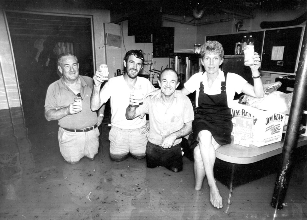
In 1984 torrential rain produced Gunnedah’s highest flood level in 13 years (8.84 metres). There was an air of calm, however, as residents had become used to flooding and knew how to react ahead of the flood peak.
The North West rail line was washed out over a distance of more than 500 metres. After falls of 200mm (eight inches), the rail embankment was breached near Peach Tree Gully, between Gunnedah and Curlewis, and ballast was washed away, leaving the line hanging in mid-air.
Ashford’s Watercourse and Blackjack Creek in the town area became raging torrents and damage from local water occurred where flooding had never been seen before.
There was also flash flooding in Curlewis, with local water entering eight homes.
Another major flood occurred in Gunnedah in late July 1984, the Namoi reaching a height of eight metres.
As the years roll by, the rich and fertile Namoi Valley continues to reflect the words of poet Dorothea Mackellar in her iconic poem My Country – “of droughts and flooding rains”.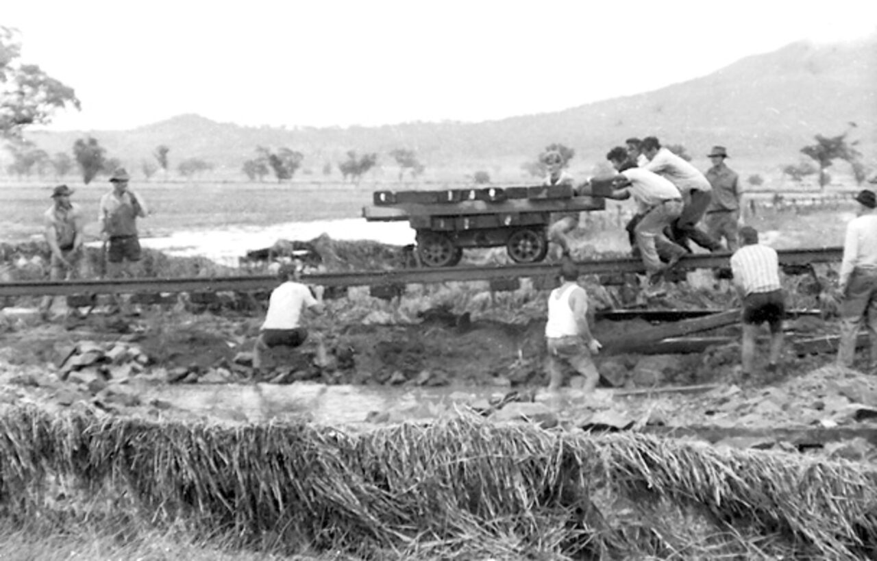
Several hundred metres of railway line had to be repaired at Peach Tree Gully on the Curlewis Road after the 1976 flood. Floodwaters washed away the line embankment, leaving sections of track suspended.
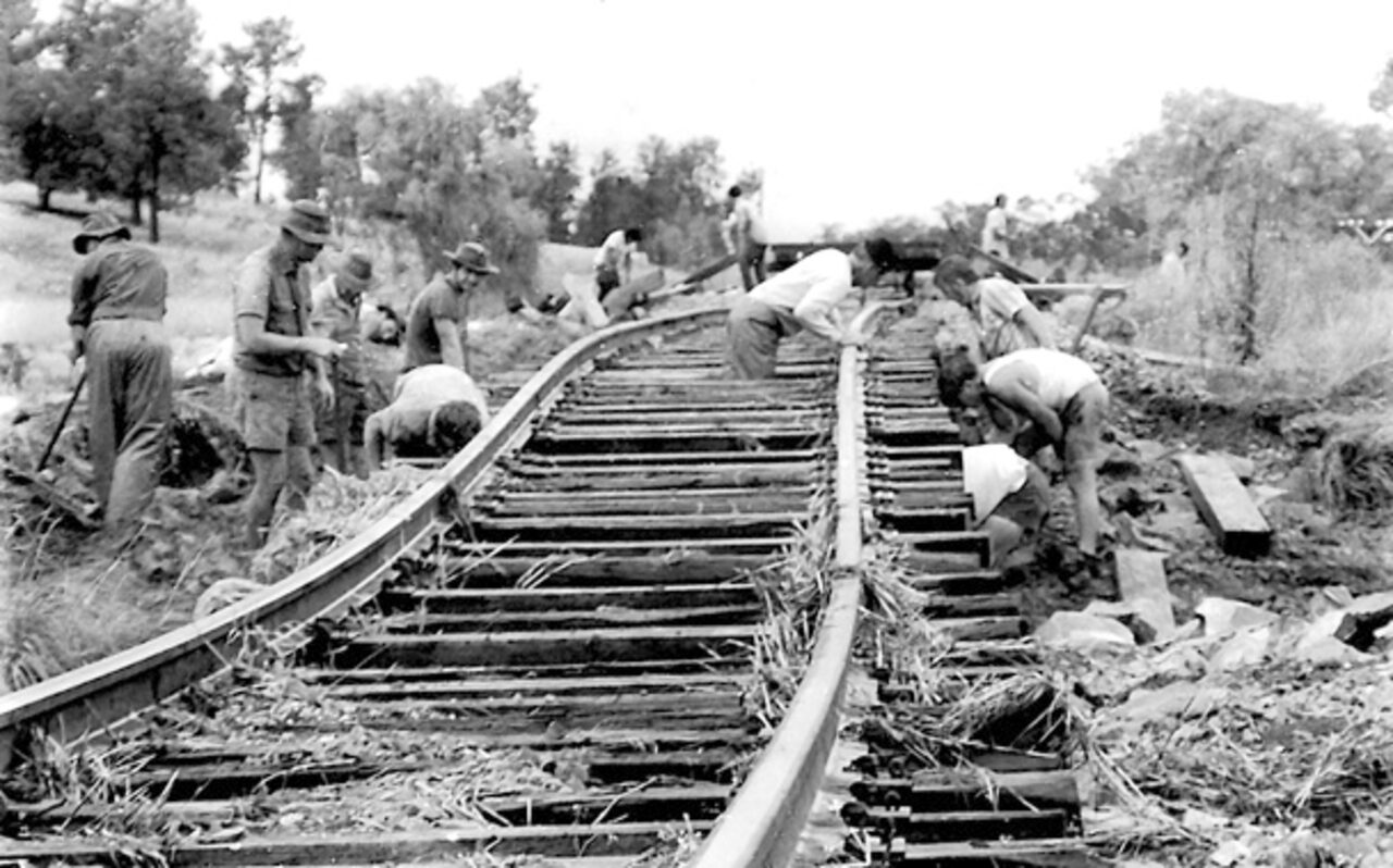
Another view of repair work on the Peach Tree Gully section.
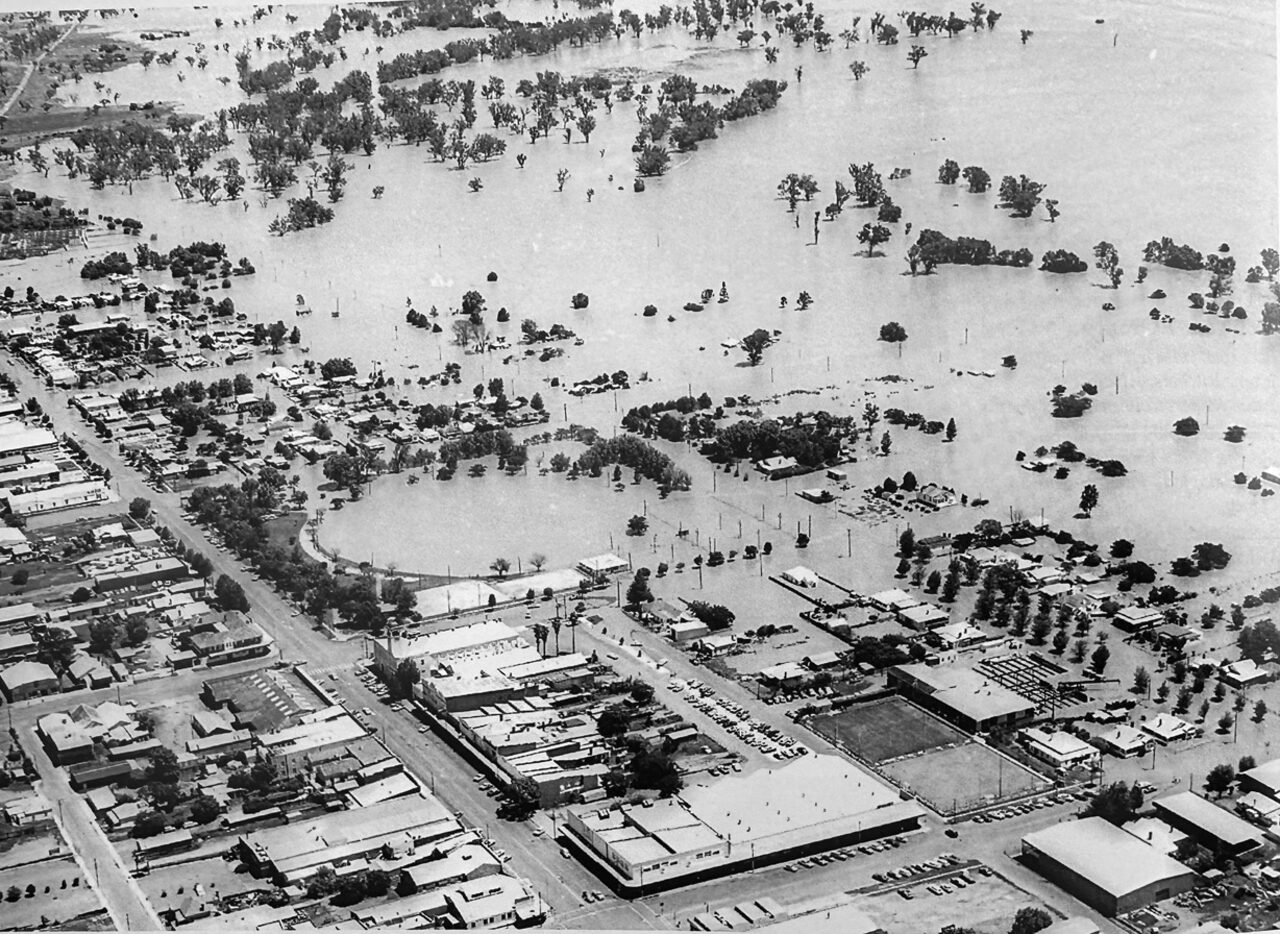
It was the decade of flood in the Namoi Valley in the 1970s. The 1971 flood was the third largest in Gunnedah’s history and there were major floods in 1974, 76, and 77. This aerial photo of Gunnedah was taken at the height of the 1976 flood.
To order photos from this page click here