Rob Hooke was among those attending Saturday’s ‘Big Map’ community engagement event at Gunnedah.
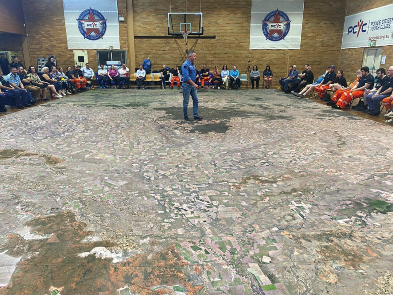
The Gunnedah shire councillor saw the large scale map (pictured) as having multiple benefits for the region – not only in flood mitigation for the community but also water storage and allocation for landholders.
“It’s a clever source of information to be able to look over a broad area and plan strategically,” Cr Hooke said.
“Having that visual effect, there’s nothing quite like it.”
He thought it would be particularly advantageous for emergency services on the ground during times of flood or even fire.
“They can really visualise where the water spread is and where it’s going,” he said. Cr Hooke said the benefits of such the map, which covered half a basketball court, could be extended to those involved in the Murray Darling Basin Plan.
He said people could see exactly where the rivers run and the catchment areas, relative to other river systems and water storages.
To order photos from this page click here


