An $80,000 concrete causeway to service just one neighbouring property has brought a rural subdivision to a standstill before it even started.
Emerge Developments – owned and operated by Gunnedah’s Avard family – is seeking to develop six, small acreage lots off Eveleigh Road, south of Gunnedah.
The proposed blocks are an extension of an existing, 41-lot rural residential subdivision which the Avards have been developing in the foothills of Porcupine Reserve for the last 15 years.
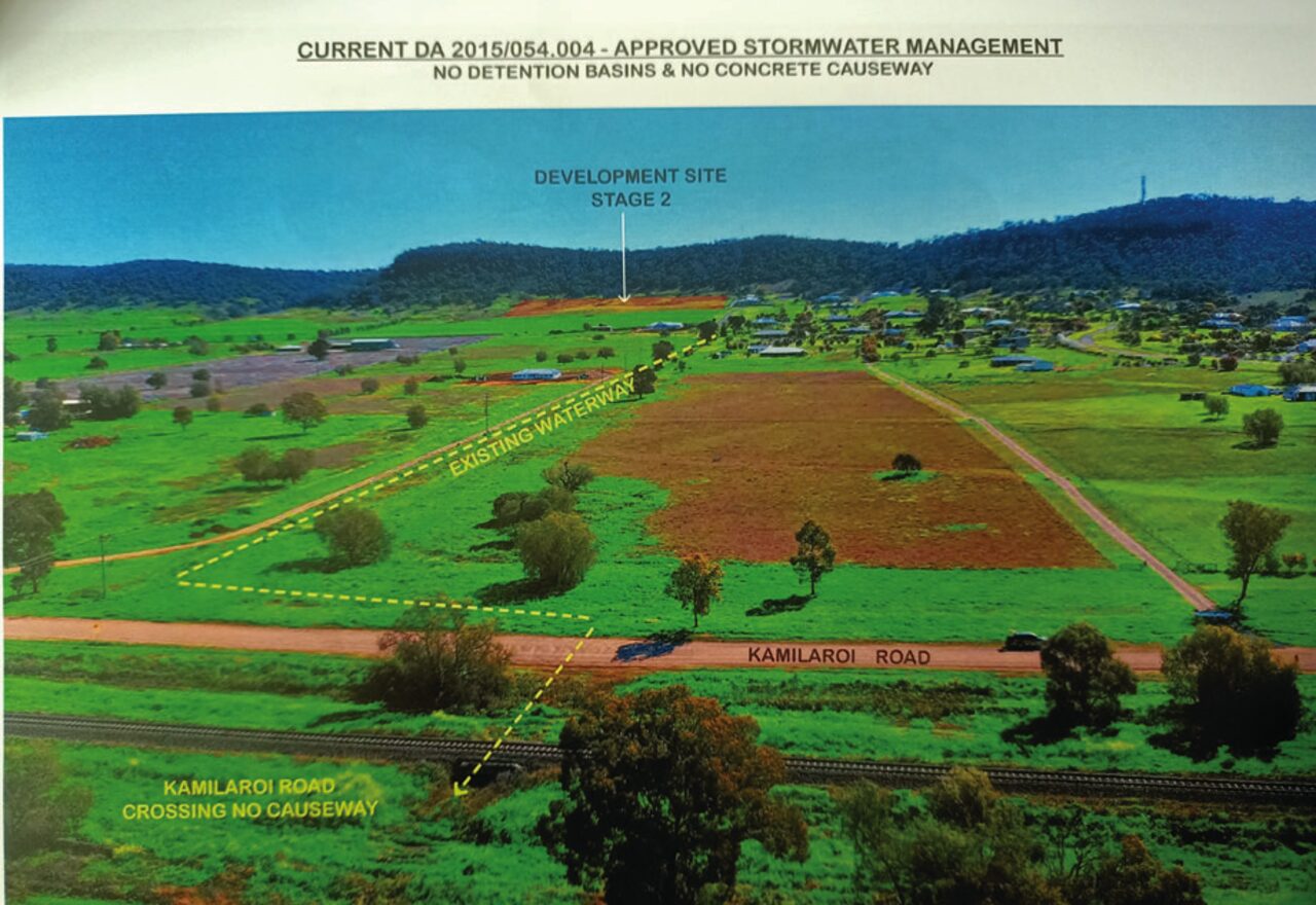
The developers already have Gunnedah Shire Council’s approval for the new development but only if the water is re-directed in the opposite direction to the apparent natural fall of the land.
Under the current approval, this run-off would be channelled into a watercourse running through backyards of four existing properties.
Developers say this is unsuitable as the waterway cannot take any additional water – highlighted by the fact it reached its maximum limit during a 1 in 100-year rain event in December 2020 which dumped 95mm of rain in the area in just 65 minutes.
Chris Avard said mitigating this risk was not possible and they cannot proceed with the subdivision under current conditions.
“While we have approval for a number of lots going forward, recent rain events have shown the current infrastructure is working at capacity,” Chris said.
“We feel it would be unconscionable for us to execute our approved development because of the impact on landholders and ratepayers at the foot of the development,” Chris added.
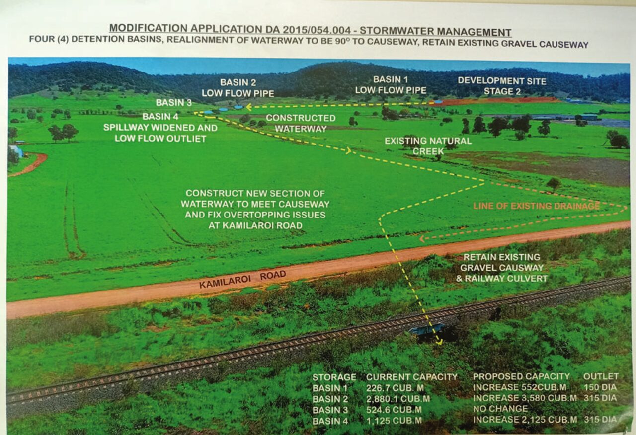
Instead, the developers propose to run excess water from the new proposed blocks in the opposite direction toward vacant land owned by the Avards.
Under this plan, water would flow along contour banks into a waterway and exit 2km to the development’s east – still within the Avard’s property boundary.
To help mitigate water flow during this 2km journey, developers have enlarged four existing dams for water storage detention, complete with slow release pipes to lessen the stormwater impact.
Where the stormwater exits the Avard’s property onto the gravel section of Kamilaroi Road, which runs parallel to the Kamilaroi Highway, council stated a concrete causeway or culvert was required. Council said this would ensure the existing road network was not degraded by the proposed alteration to the stormwater design.
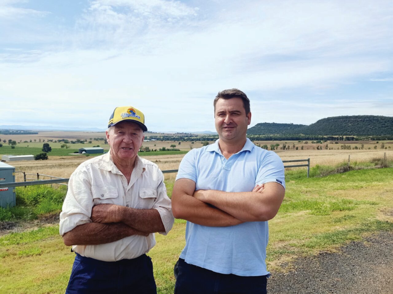
In a recent letter to the Gunnedah Times, Chris’ father George, said the road modification was completely unnecessary.
“I have lived here for 76 years and our engineers agreed this was totally unnecessary for [the water] never cut the road, services only two properties and was the least of four causeways to create a problem,” George said.
“If they approve the first six blocks it would generate approximately $150,000 [in income] in first year when the homes are built,” George said, referring to his estimate from council’s rates, levies and headworks charges.
The father and son said not only had water been directed down this same grassed waterway for the last 60 years with no issues – this all before the upgraded storage detention dams – they highlighted a low depression in Kamilaroi Road several hundred metres away where washouts and flooding demanded greater causeway priority.
Chris also believed the road structure was unnecessary and claimed council suggested, as developers, they should pass on the cost incurred to land buyers.
“The causeway or culvert would only service two landholders – us being one of them and a neighbour who has agreed there is no need for one,” he said.
“It would add cost to our development but the attitude of council that we can just inflate the price of the blocks we bring to market should be the outcome, is really reflective of their attitude toward raising costs for ratepayers and land buyers.
“There is no need for it.”
Developers also noted the presence of a secondary exit over the railway line south of the existing crossing at Kamilaroi Road.
They also said the stormwater plan had been modified at the request of council staff to eliminate a 90 degree turn at the end of the waterway to improving drainage in the area.
Chris said council’s demands were unreasonable given the mitigation commitments already fulfilled such as detention dams and waterway modifications.
“It’s disappointing because we feel [our plan] is a very sensible compromise,” he said.
“There is no impact on anybody but there’s no consideration by council members or staff to entertain a sensible outcome.
“We’re focused on a commercial outcome, as developers are, but it’s just reflective of their attitude to just put up the cost and someone will pay for it down the track.”
If no solution is found, Chris said the land would return to agricultural use despite high housing demand.
“If we can’t reach an amendment, if we can’t adjust our approval, we can’t proceed and we’ll have to keep farming the block,” he said.
“It’s six blocks that won’t immediately come to market or the next stage down the track.
“We’ve given people downstream who might be affected our word that if can’t get the approvals, it just won’t happen.”
The development roadblock comes at a challenging time for housing development – not only in Gunnedah but across the state and the country.
Governments at all levels are focused on solutions to solve the tightening housing market but problems continue to plague the system.
Bureau of Statistics released just this month showed Australia’s building approvals slipped 3.6 per cent to 14,998 dwellings in November.
According to the Gunnedah Shire Local Housing Strategy published in 2023, demand for housing remains strong in Gunnedah and will likely continue to 2041.
The report noted the population was projected to grow, generating demand for additional housing and at a minimum, there was a need for 580 additional dwellings to accommodate anticipated growth to 2041.
Gunnedah Shire Council’s initial response to the DA modification, published December 2024
“As per council’s Engineering Guidelines for Subdivisions and Developments 2013, where open channels are required to cross formed roads, they shall do so via culverts sized to match the flow conditions,” the report states.
“Council’s assessment has determined that the modification proposal would direct additional water to this natural water course which would result in additional water passing over Kamilaroi Road in this one location creating further damage to the road surface during rainfall events.
“To ensure that the proposal does not result in additional damage occurring to the unsealed section of Kamilaroi Road or a need for more frequent repairs to the road, council requested that a condition be included which required the construction of a culvert under the road or concrete sealing of the crossing of Kamilaroi Road. This would ensure that the additional water being directed over Kamilaroi Road from the modification, does not result in additional maintenance requirements from council and a greater cost to the community.
“The developer rejected the request and indicated that they would not be willing to complete any works on the stormwater crossing on Kamilaroi Road. Hence, the conclusion is that the modification is not supported as it would result in unmanaged impacts to council’s infrastructure.”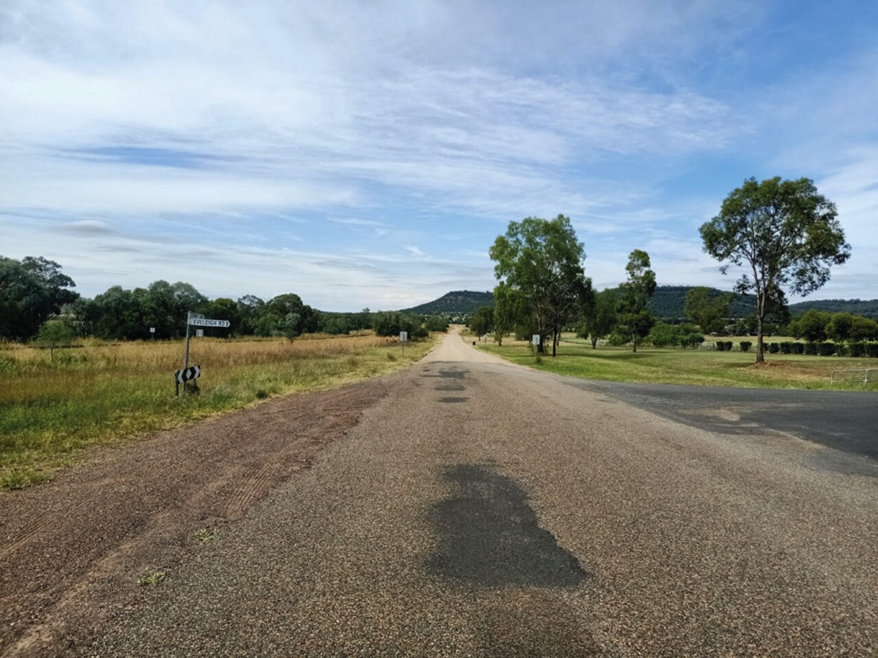
Kamilaroi Road, corner of Eveleigh Road and Debney Lane.
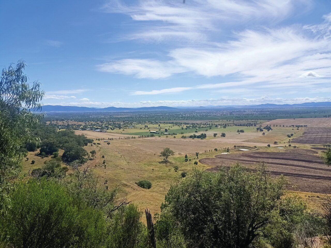
The view east from Porcupine Reserve overlooking Kamilaroi Road and the some of the area where the new Gunnedah residential subdivision is proposed.
To order photos from this page click here